
With decades of experience in management consulting, Marco Gaietti is a seasoned expert in Business Management. His expertise spans a broad range of areas, including strategic management, operations, and customer relations, with a particular focus on how high-tech infrastructure can be leveraged to meet the world’s most pressing environmental goals. By examining the intersection of computational power and ecological stewardship, he provides a unique perspective on the operational shifts required to protect our planet’s future.
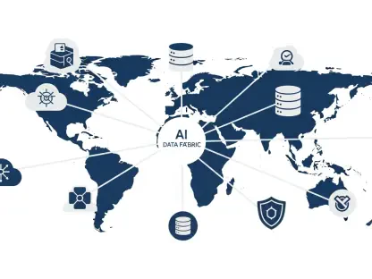
Our conversation explores how hyper-local weather forecasting is revolutionizing urban resilience and how automated imagery is being used to protect endangered species in dense rainforests. We also dive into the industrial efficiency of AI-integrated waste management and the life-saving potential of real-time tsunami alerts powered by high-speed seismic analysis. Finally, we look at the role of edge computing in satellites and how moving data processing to orbit is shortening the critical window for wildfire response from hours to seconds.
How does the level of granularity provided by Earth-2 improve urban planning for extreme weather, and what specific data assimilation techniques allow for such rapid preprocessing on a single GPU?
The kilometer-level granularity of the Earth-2 platform is a complete game-changer because it allows city officials to visualize storm impacts down to a specific neighborhood, transforming abstract data into actionable evacuation routes. In the past, broader models might miss the specific micro-climates of a city, but this “nowcasting” model provides hyper-local, six-hour predictions that are incredibly precise. By utilizing the HealDA architecture, developed alongside NOAA and MITRE, we can now preprocess massive atmospheric datasets on a single GPU rather than an entire server farm. This efficiency means that what used to take hours of computational heavy lifting now happens in mere minutes, allowing for 15-day global predictions or storm-level insights at record speeds. It removes the guesswork from urban planning, allowing for the deployment of flood barriers or emergency crews exactly where the rain will hit hardest before the first drop even falls.
What are the primary hurdles in training models for such complex terrains as rainforests, and how does reducing processing time from hours to minutes fundamentally change conservation strategies?
Training models for rainforest environments is notoriously difficult because the canopy is a dense, chaotic tapestry of greens and shadows that can easily hide or mimic signs of life. The primary hurdle is teaching an algorithm to distinguish between a pile of tangled branches and a carefully constructed orangutan nest when viewed from a moving drone. By achieving over 99% accuracy in Borneo and Sumatra, we move away from the grueling frustration of manual image review, which used to consume hours of precious time for conservationists on the ground. This shift to a process that takes mere minutes allows teams to respond to poaching threats or habitat loss in real-time, effectively turning drones into a persistent, vigilant shield for endangered populations. Seeing these results creates a palpable sense of hope for researchers who are no longer buried under thousands of static images and can instead focus on active protection.
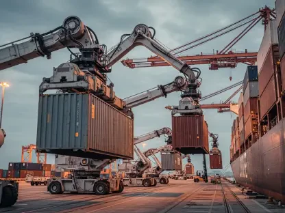
Beyond material sorting, how does AI-integrated robotics reduce the energy footprint of a waste facility, and what metrics should facility managers track to optimize these automated systems?
When you walk into a modern waste facility integrated with AI robotics, you immediately notice a level of clinical precision that human hands simply cannot match. By reaching a 90% recovery rate, these systems—such as those developed by AMP Robotics—ensure that almost everything valuable is saved from the landfill, which has already resulted in over 2 billion pounds of material being diverted. This technology reduces the energy footprint of a plant by optimizing the movement of robotic arms and reducing the need for repetitive, high-energy mechanical sorting that often runs less efficiently. Facility managers should track metrics like the purity of sorted bales and the recovery rate per hour to truly see the efficiency gains in their operations. It’s not just about sorting trash; it’s about creating a circular economy where the waste becomes a streamlined, profitable asset through the use of NVIDIA GPUs and specialized software.
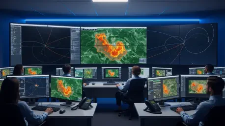
What are the technical requirements for ensuring seismic prediction systems remain operational during a catastrophic event, and how do researchers validate the accuracy of such high-speed predictions?
During a catastrophic event, every second is a heartbeat that could mean the difference between life and death for thousands of people in disaster-prone regions. The technical requirements for these systems are intense; they must reside on robust, GPU-powered infrastructure that can process complex seismic data and predict tsunami impacts within seconds while the ground is literally shaking. Researchers from institutions like UT Austin validate these high-speed predictions by running historical data from previous events through the model to ensure the output matches the real-world devastation seen in the past. This provides a necessary sense of certainty and calm for emergency managers who must make high-stakes decisions under immense psychological pressure. In areas like the Pacific Northwest, having this level of foresight is the ultimate safeguard against the unpredictable and terrifying power of the ocean.
How does the shift from centralized to on-orbit processing change the immediate workflow for emergency services, and what step-by-step improvements will further bridge the gap between detection and action?
Moving the processing of satellite data from ground stations to the satellites themselves—what we call on-orbit edge computing—completely rewrites the script for emergency services. Instead of waiting hours for a signal to be beamed down, processed at a central hub, and then sent back to the field, first responders receive wildfire insights in seconds. This immediate workflow means that a fire can be spotted and mapped before it even has the chance to crest a ridge, allowing for a much faster deployment of aerial tankers and ground crews. To further bridge the gap between detection and action, we need a step-by-step improvement in direct communication links between satellite platforms and local fire departments. The sensory experience of receiving a live heat map while a fire is still in its infancy is a total paradigm shift for those working on the front lines of environmental disasters.
What is your forecast for AI-driven sustainability?
My forecast for AI-driven sustainability is that we are entering an era where environmental stewardship and corporate profitability are no longer at odds, but rather two sides of the same coin. We will see industries across the board adopting platforms like Earth-2 to mitigate risk and optimize resources, leading to a sustained surge in demand for high-performance hardware that can handle these massive simulations. This isn’t just a seasonal trend; it’s a fundamental shift in how we value global resources, where computational efficiency becomes the primary driver of both ecological health and market value. As we look ahead, the integration of AI into every facet of sustainability will likely be the single most important factor in how we navigate the climate challenges and environmental risks of the next decade.