
Construction projects have evolved into high-stakes data management operations where a single oversight in spatial coordination can result in millions of dollars in losses. As the global landscape becomes more densely populated and environmental regulations tighten, the margin for error has diminished to the point where traditional blueprints are becoming relics of a less complex era. Today, Geographic Information Systems (GIS) provide the vital spatial intelligence needed to navigate these intricacies by layering vast amounts of topographical, social, and environmental data over building plans. This technology creates a dynamic framework that allows every stakeholder to see the project not just as a static design, but as a living entity within its surrounding environment. By bridging the gap between digital models and physical reality, GIS ensures that modern infrastructure is resilient, efficient, and perfectly integrated into the world it inhabits. This shift represents a transition from viewing projects in isolation to understanding them as part of a larger, interconnected geographic context.
Addressing the Challenges of Data Fragmentation
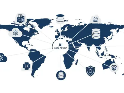
Overcoming Information Silos with Spatial Intelligence
The construction industry has long struggled with the “silo effect,” where critical information remains trapped within specific departments or disconnected software systems. On large-scale projects involving hundreds of stakeholders, this fragmentation leads to delayed decision-making and expensive errors that could have been avoided with better communication. GIS technology solves this by using geography as a primary organizing principle, anchoring schedules, material logs, and safety reports to specific geographic coordinates. This creates a “single source of truth” that transforms abstract data into an actionable, visual map of project progress. By centralizing information in a spatial database, contractors and architects can see the exact status of any component in real-time. This level of transparency eliminates the need for manual data cross-referencing, allowing teams to identify potential design clashes or logistical overlaps before they become critical issues on the ground, ultimately saving time and resources.
Transforming Abstract Data into Actionable Insights
Beyond simple mapping, GIS serves as a comprehensive data processing platform that reveals spatial patterns invisible in traditional spreadsheets or basic CAD files. In modern construction, these applications are typically categorized into spatial planning, task tracking, defect detection, and safety monitoring. By connecting high-fidelity design models with the real-world conditions of the field, project managers can visualize the intricate relationships between site constraints and available resources. For instance, analyzing the proximity of heavy equipment to underground utility lines through a GIS interface prevents accidental disruptions that frequently plague urban development. The ability to overlay historical weather patterns or soil stability data onto the construction schedule allows for a sophisticated level of risk assessment. This analytical depth ensures that every decision is backed by empirical evidence rather than intuition, providing a more stable foundation for the complex logistics required in today’s multi-billion dollar infrastructure initiatives.
Streamlining Planning and On-Site Operations
Enhancing Pre-Construction Accuracy and Resource Logistics
The impact of GIS is most profound during the pre-construction phase, where it integrates environmental data with existing utility networks. This allows teams to identify potential conflicts and scheduling dependencies before any ground is broken on the site. Instead of relying on outdated paper surveys or incomplete digital archives, firms use real-world geographic data to simulate alternative construction approaches. This proactive design strategy reduces the likelihood of costly “surprises” during excavation and ensures that the project remains compliant with local environmental and government regulations. By analyzing terrain slopes and drainage patterns, engineers can design more effective foundation systems and storm-water management solutions. This level of foresight is essential in 2026, where the emphasis on sustainable development requires builders to minimize their environmental footprint. Accurate spatial modeling allows for the preservation of local ecosystems while maintaining the structural integrity of the new build.
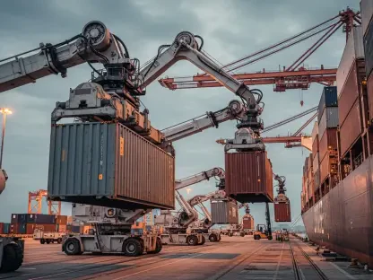
Optimizing Site Logistics through Real-Time Tracking
Once construction begins, GIS combined with GPS technology provides continuous operational awareness by tracking the movement of materials, equipment, and personnel. Because a vast majority of construction data has a geographic component, managers can monitor material flows to prevent shortages and track heavy machinery to minimize idle time. This shift from reactive to proactive management allows for logistics optimization, as site leaders can identify bottlenecks and adjust delivery routes based on real-time site congestion. For example, a project manager can see exactly when a shipment of structural steel arrives at the gate and direct it to the specific unloading zone without interfering with other active crews. This coordination is vital for maintaining the rigorous timelines of modern projects. Furthermore, by analyzing the travel paths of heavy equipment over the course of a week, firms can redesign site layouts to reduce fuel consumption and wear on machinery, leading to significant operational cost savings and improved efficiency.
Prioritizing Site Safety and Risk Mitigation
Safety is a primary concern in construction, and GIS provides powerful tools for mitigating site-specific risks through precise spatial analysis. By mapping environmental factors and historical data, the technology can identify if a site is vulnerable to geographical hazards like floods or wildfires before workers even arrive. During the active build phase, safety officers use spatial analysis to map “near-misses” and incident locations. When these events are viewed on a map, patterns often emerge—such as high-risk zones caused by poor lighting, equipment congestion, or hazardous terrain—allowing for targeted preventive measures. This data-driven approach moves safety management away from generic checklists toward site-specific interventions. Automated geofencing can also be established to alert supervisors if a worker enters a restricted area without the proper clearance or protective equipment. This real-time monitoring capability creates a proactive safety culture where potential accidents are neutralized before they can occur.
Analyzing Historical Performance for Long-Term Safety
A notable example of this data-driven approach is seen in the modernization of utility infrastructure, where legacy platforms often face the risk of data loss. As these older systems reach their end-of-life, the potential for operational outages and safety hazards grows significantly. Successful GIS implementation requires a blend of technical expertise and industry knowledge to ensure continuity between old records and new digital systems. By moving to a modern geospatial framework, large entities can empower their teams with advanced spatial capabilities that protect assets and improve long-term project tracking. This transition involves digitizing decades of historical records into a format that current GIS software can interpret and analyze. Once this data is integrated, managers can perform predictive maintenance on aging assets, identifying components that are likely to fail based on their age, location, and exposure to environmental stressors. This historical perspective is invaluable for maintaining the safety and reliability of public infrastructure over several decades.
Integrating Innovation and Ensuring Long-Term Success
Leveraging Advanced Technologies: BIM and IoT Integration
The future of the industry lies in the convergence of GIS with Building Information Modeling (BIM), Artificial Intelligence (AI), and the Internet of Things (IoT). While BIM focuses on the intricate internal design of a structure, GIS provides the essential context of where that structure exists and how it interacts with its environment. This fusion enables the creation of Digital Twins—virtual replicas of physical assets—where managers can conduct risk-free simulations of various scenarios. IoT sensors placed throughout the job site feed real-time data into these models, creating a living representation of a project’s health and progress. These sensors can monitor everything from concrete curing temperatures to the vibration levels of nearby structures. By applying AI algorithms to this stream of spatial data, firms can predict project delays or identify quality control issues that might be invisible to the human eye. This integration allows for a level of precision and control that was previously impossible in the construction field.
Ensuring Seamless Implementation and Scalability
For firms ready to adopt these tools, the primary focus must be on interoperability and scalability to ensure the technology provides long-term value. A GIS platform is only effective if it can communicate seamlessly with existing CAD and ERP systems to eliminate data silos once and for all. Furthermore, the chosen system must be able to handle increasing data volumes as a firm’s portfolio grows from a few regional projects to a global operation. By maintaining consistent data standards across all project phases, construction companies ensure that the information gathered during the build remains useful for the long-term maintenance of the finished asset. This requires a commitment to rigorous data governance and the training of personnel to ensure that every team member can contribute to and benefit from the spatial database. Scalability also means that the system can evolve, incorporating new sensor types or satellite imagery as they become available, keeping the firm at the forefront of the technological landscape.
Strategic Implementation for Enduring Infrastructure
Organizations that prioritized the integration of spatial intelligence into their core workflows secured a competitive advantage in an increasingly complex market. These firms moved beyond basic mapping and treated GIS as the central nervous system for their entire operational lifecycle. They established clear protocols for data entry and invested in cloud-based platforms that allowed field workers to update site conditions from mobile devices instantly. This transition required a shift in company culture where data accuracy was valued as much as physical progress. Management teams focused on training employees to interpret spatial insights, ensuring that the benefits of GIS reached every level of the organization. By adopting these strategies, they transformed construction from a series of disjointed tasks into a synchronized, data-driven discipline. These leaders moved toward a model where every decision was verified through spatial simulation, which drastically reduced the incidence of rework and maximized the long-term viability of the assets they built.